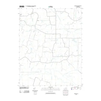
2010 Map of Milburn
USGS Topo · Published 2010About this map
Bardwell Cemetery and Elsey Cemetery anchor the northern landscape of this Carlisle County region, where the terrain is defined by a dense network of small tributaries. The hydrology of the area is particularly complex, with Horn Creek and Hopewell Creek carving through the center of the quadrangle before joining larger systems like the West Fork Mayfield Creek. The rural road system follows a distinct grid-and-valley pattern, with local routes such as Williams Chapel Rd and Willow Creek Rd connecting family farms and historical burial sites like the Holder Cemetery. This early 21st-century documentation captures a transition in land use, showing the persistence of traditional family landmarks amidst an evolving network of county roads including Arlington-US 51 Rd and numerous numbered county routes that stitch together the agricultural landscape.
Find a feature on this map
45 named features on this map. Tap any name to fly to it.
Don’t see what you’re looking for? This feature index may not catch every label — zoom into the map to look around manually.
Map Details
Editions of this 2010 Milburn Map
This is the sole edition of this map. No revisions or reprints were ever made.
Other maps of this area

1939 · Wickliffe
USGS Topo · 1:62,500

1939 · Hickman
USGS Topo · 1:62,500

1951 · Blandville
USGS Topo · 1:24,000

1951 · Oakton
USGS Topo · 1:24,000

1951 · Arlington
USGS Topo · 1:24,000

1951 · Wickliffe
USGS Topo · 1:24,000

1951 · Milburn
USGS Topo · 1:24,000

1952 · Clinton
USGS Topo · 1:24,000

1952 · Dublin
USGS Topo · 1:24,000

1952 · Fancy Farm
USGS Topo · 1:24,000