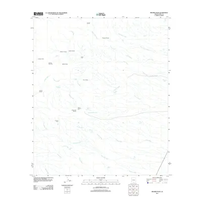
2011 Map of Mildred Peak
USGS Topo · Published 2011About this map
Mildred Peak and Osobavi Peak dominate this corner of the Sonoran desert, overlooking a landscape defined by an intricate network of desert washes and isolated ranching outposts. The drainage patterns of Shaffer Wash, Thomas Canyon Wash, and Las Moras Wash trace the natural movement of water through the arid terrain toward the south. Cattle ranching history is evidenced by the presence of Santa Margarita Ranch, Las Moras Ranch, and Shaffer Camp, along with numerous water management features like Cemetery Tank, Milpa Tank, and the Clemente Windmill. This 2011 survey captures the area’s reliance on these widely dispersed water sources, from Corodope Spring to specialized catchment basins like Jackknife Tank and Seven X Tank, reflecting the long-standing livestock operations that persist in this part of Pima County.
Find a feature on this map
41 named features on this map. Tap any name to fly to it.
Don’t see what you’re looking for? This feature index may not catch every label — zoom into the map to look around manually.
Map Details
Editions of this 2011 Mildred Peak Map
This is the sole edition of this map. No revisions or reprints were ever made.
Other maps of this area

1920 · Arivaca
USGS Topo · 1:125,000

1940 · Palo Alto Ranch
USGS Topo · 1:62,500

1941 · Presumido Peak
USGS Topo · 1:62,500

1941 · Baboquivari Peak
USGS Topo · 1:62,500

1941 · Arivaca
USGS Topo · 1:62,500

1943 · Fresnal
USGS Topo · 1:125,000

1943 · Arivaca
USGS Topo · 1:62,500

1943 · Palo Alto Ranch
USGS Topo · 1:62,500

1943 · Presumido Peak
USGS Topo · 1:62,500

1944 · Baboquivari Peak
USGS Topo · 1:62,500