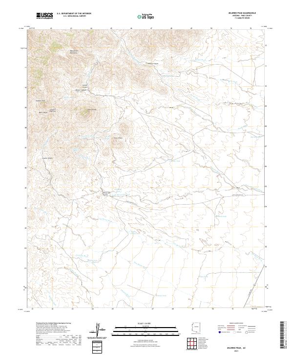
2021 Map of Mildred Peak
USGS Topo · Published 2021About this map
Mildred Peak and the high ridges of the Baboquivari Mountains dominate this arid landscape, where water management is the primary evidence of human activity. The map reveals an intricate network of washes and canyons, such as Thomas Canyon and Jupiter Canyon, that funnel seasonal runoff toward strategically placed reservoirs. Ranching and land use are marked by numerous named water features, including Cemetery Tank, Mormon Tank, and Mitchell Tank, essential for sustaining life and livestock in this environment.
Find a feature on this map
78 named features on this map. Tap any name to fly to it.
Don’t see what you’re looking for? This feature index may not catch every label — zoom into the map to look around manually.
Map Details
Editions of this 2021 Mildred Peak Map
This is the sole edition of this map. No revisions or reprints were ever made.
Other maps of this area

1920 · Arivaca
USGS Topo · 1:125,000

1940 · Palo Alto Ranch
USGS Topo · 1:62,500

1941 · Presumido Peak
USGS Topo · 1:62,500

1941 · Baboquivari Peak
USGS Topo · 1:62,500

1941 · Arivaca
USGS Topo · 1:62,500

1943 · Fresnal
USGS Topo · 1:125,000

1943 · Arivaca
USGS Topo · 1:62,500

1943 · Palo Alto Ranch
USGS Topo · 1:62,500

1943 · Presumido Peak
USGS Topo · 1:62,500

1944 · Baboquivari Peak
USGS Topo · 1:62,500