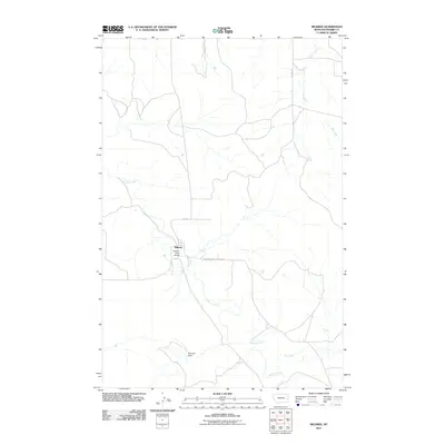
2011 Map of Mildred
USGS Topo · Published 2011About this map
Mildred sits as a central hub of activity within this Prairie County landscape, defined by its position at the intersection of local routes and the meandering path of O'Fallon Creek. The settlement's infrastructure is anchored by the O'Fallon Creek Bridge, which facilitates movement across the drainage basin. To the north and east, the terrain is etched by a series of waterways, including Spring Creek, Ash Creek, and Pine Creek, illustrating the drainage patterns that have long shaped ranching and travel in this part of Montana.
Find a feature on this map
10 named features on this map. Tap any name to fly to it.
Don’t see what you’re looking for? This feature index may not catch every label — zoom into the map to look around manually.
Map Details
Editions of this 2011 Mildred Map
This is the sole edition of this map. No revisions or reprints were ever made.
Other maps of this area

1953 · Miles City
USGS Topo · 1:250,000

1957 · Miles City
USGS Topo · 1:250,000

1958 · Miles City
USGS Topo · 1:250,000

1966 · Fallon
USGS Topo · 1:24,000

1966 · Marsh SW
USGS Topo · 1:24,000

1969 · Little Whitney Creek
USGS Topo · 1:24,000

1969 · Flat Top Butte NE
USGS Topo · 1:24,000

1980 · Terry
USGS Topo · 1:100,000

1981 · Mildred NE
USGS Topo · 1:24,000
1981 · Loony Hollow
USGS Topo · 1:24,000