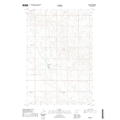
2020 Map of Mildred
USGS Topo · Published 2020About this map
Mildred serves as the focal point of this Prairie County landscape, situated where Hwy 340 meets the winding course of O'Fallon Cr. The topography is defined by a dense network of coulees and drainage systems, with the O'Fallon Creek Bridge marking a critical crossing point for local transit. The settlement pattern is dictated by these watercourses, with several intermittent streams such as Spring Cr, Ash Cr, and Pine Cr carving paths through the terrain.
Find a feature on this map
16 named features on this map. Tap any name to fly to it.
Don’t see what you’re looking for? This feature index may not catch every label — zoom into the map to look around manually.
Map Details
Editions of this 2020 Mildred Map
This is the sole edition of this map. No revisions or reprints were ever made.
Other maps of this area

1953 · Miles City
USGS Topo · 1:250,000

1957 · Miles City
USGS Topo · 1:250,000

1958 · Miles City
USGS Topo · 1:250,000

1966 · Fallon
USGS Topo · 1:24,000

1966 · Marsh SW
USGS Topo · 1:24,000

1969 · Little Whitney Creek
USGS Topo · 1:24,000

1969 · Flat Top Butte NE
USGS Topo · 1:24,000

1980 · Terry
USGS Topo · 1:100,000

1981 · Mildred NE
USGS Topo · 1:24,000
1981 · Loony Hollow
USGS Topo · 1:24,000