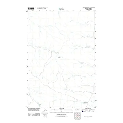
2011 Map of Miles City Creek
USGS Topo · Published 2011About this map
Miles City Creek and Mizpah Creek converge in this high-plains landscape within Custer County, Montana. The terrain is defined by an intricate network of drainage systems, including South Fork Second Creek, Third Creek, and Fourth Creek, which carve through the open range. Human modification of the environment is evident through several named earthwork structures, such as Tonn Number 7 Dam and Robinson Number 2 Dam, serving as vital water management points for the local ranching economy. This 2011 survey documents a sparsely populated region where ephemeral watercourses like Windmill Creek and Short Creek dictate the utility of the land. The presence of features like Tonn Number 4 Dam near Deer Creek highlights the long-standing family ranching legacies that have shaped the use of this Montana territory.
Find a feature on this map
15 named features on this map. Tap any name to fly to it.
Don’t see what you’re looking for? This feature index may not catch every label — zoom into the map to look around manually.
Map Details
Editions of this 2011 Miles City Creek Map
This is the sole edition of this map. No revisions or reprints were ever made.
Other maps of this area

1953 · Miles City
USGS Topo · 1:250,000

1954 · Ekalaka
USGS Topo · 1:250,000

1956 · Ekalaka
USGS Topo · 1:250,000

1957 · Miles City
USGS Topo · 1:250,000

1958 · Miles City
USGS Topo · 1:250,000

1958 · Ekalaka
USGS Topo · 1:250,000

1965 · Ekalaka
USGS Topo · 1:250,000

1969 · Mizpah
USGS Topo · 1:24,000

1969 · First Creek
USGS Topo · 1:24,000

1969 · Loaf of Bread Butte
USGS Topo · 1:24,000