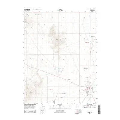
2014 Map of Milford
USGS Topo · Published 2014About this map
Milford serves as the primary hub of this 2014 survey, where the grid of the town site meets the Beaver River and the vast Escalante Desert. This high-desert landscape is defined by its water management and stark relief, featuring the Big Wash Reservoir and Lower Big Wash Reservoir alongside the Rocky Range and the Star Range. The town's local infrastructure is well-documented, including the Milford City Cem and the Milford Municipal / Ben and Judy Briscoe Field Airport. To the north, the settlement of Blueacre sits near the base of the Beaver Lake Mountains, while the uniquely named Mollies Nipple provides a distinct navigational landmark to the south. The complex transportation network includes a series of local thoroughfares like Pioche Rd and Golf Course Rd, reflecting the community's modern layout and its relationship with the surrounding Beaver County terrain.
Find a feature on this map
40 named features on this map. Tap any name to fly to it.
Don’t see what you’re looking for? This feature index may not catch every label — zoom into the map to look around manually.
Map Details
Editions of this 2014 Milford Map
This is the sole edition of this map. No revisions or reprints were ever made.
Other maps of this area

1885 · Beaver
USGS Topo · 1:250,000

1953 · Milford Flat
USGS Topo · 1:24,000

1953 · Cave Canyon
USGS Topo · 1:24,000

1953 · Richfield
USGS Topo · 1:250,000

1958 · Richfield
USGS Topo · 1:250,000

1958 · Milford
USGS Topo · 1:62,500

1958 · Milford
USGS Topo · 1:24,000

1958 · Adamsville
USGS Topo · 1:62,500

1958 · Ranch Canyon
USGS Topo · 1:24,000

1960 · Beaver Lake Mts.
USGS Topo · 1:62,500