
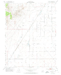
1953 Map of Milford Flat
USGS Topo · Published 1955About this map
The Star Range rises sharply above the eastern reaches of the Escalante Desert, defining a landscape of mid-century mining and rail activity. Patented mining claims and workings dot the slopes, including the Maud S Mine, Vicksburg Mine, Estelle Mine, and Gold Crown Mine. These operations overlook the wide expanse of Milford Flat, where the Union Pacific railroad cuts a straight line through the basin.
Find a feature on this map
31 named features on this map. Tap any name to fly to it.
Don’t see what you’re looking for? This feature index may not catch every label — zoom into the map to look around manually.
Map Details
Editions of this 1953 Milford Flat Map
2 editions found
Other maps of this area

1885 · Beaver
USGS Topo · 1:250,000

1953 · Ninemile Knoll
USGS Topo · 1:24,000

1953 · Minersville
USGS Topo · 1:24,000

1953 · Cave Canyon
USGS Topo · 1:24,000

1953 · Richfield
USGS Topo · 1:250,000

1958 · Richfield
USGS Topo · 1:250,000

1958 · Minersville
USGS Topo · 1:62,500

1958 · Thermo
USGS Topo · 1:62,500

1958 · Milford
USGS Topo · 1:62,500

1958 · Milford
USGS Topo · 1:24,000