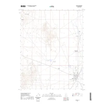
2023 Map of Milford
USGS Topo · Published 2023About this map
Milford serves as a central hub in this western Utah landscape, where the flat expanse of the Escalante Desert meets several distinctive uplands. To the west, the Star Range and the Beaver Lake Mountains provide topographic relief, while the Rocky Range sits prominently north of town. The area’s water management is evident through features like the Lower Big Wash Reservoir and West Point Reservoir, essential for a region defined by seasonal drainages such as The Big Wash and Hickory Wash.
Find a feature on this map
30 named features on this map. Tap any name to fly to it.
Don’t see what you’re looking for? This feature index may not catch every label — zoom into the map to look around manually.
Map Details
Editions of this 2023 Milford Map
This is the sole edition of this map. No revisions or reprints were ever made.
Other maps of this area

1885 · Beaver
USGS Topo · 1:250,000

1953 · Milford Flat
USGS Topo · 1:24,000

1953 · Cave Canyon
USGS Topo · 1:24,000

1953 · Richfield
USGS Topo · 1:250,000

1958 · Richfield
USGS Topo · 1:250,000

1958 · Milford
USGS Topo · 1:62,500

1958 · Milford
USGS Topo · 1:24,000

1958 · Adamsville
USGS Topo · 1:62,500

1958 · Ranch Canyon
USGS Topo · 1:24,000

1960 · Beaver Lake Mts.
USGS Topo · 1:62,500