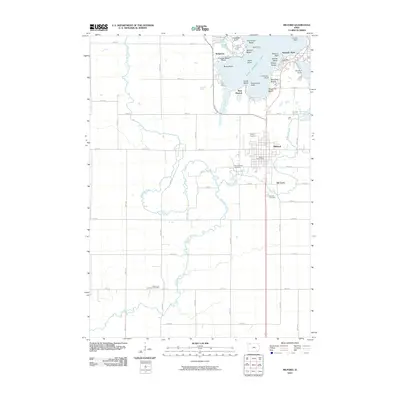
2010 Map of Milford
USGS Topo · Published 2010About this map
West Okoboji Lake defines the northeastern portion of this Dickinson County landscape, where the shoreline is densely packed with established resorts and residential developments. Coastal features such as Pocahontas Point, Gilleys Beach, and Crescent Beach Resort mark the transition from the deep blue of the lake to the surrounding Iowa prairie. South of the water, the city of Milford serves as a local hub, supported by the Milford Post Office and nearby Fuller Airport.
Find a feature on this map
56 named features on this map. Tap any name to fly to it.
Don’t see what you’re looking for? This feature index may not catch every label — zoom into the map to look around manually.
Map Details
Editions of this 2010 Milford Map
This is the sole edition of this map. No revisions or reprints were ever made.
Other maps of this area

1954 · Fairmont
USGS Topo · 1:250,000

1958 · Fairmont
USGS Topo · 1:250,000

1966 · Spencer
USGS Topo · 1:24,000

1966 · Dickens
USGS Topo · 1:24,000

1970 · Milford
USGS Topo · 1:24,000

1970 · Everly
USGS Topo · 1:24,000

1970 · Okoboji
USGS Topo · 1:24,000

1970 · Spirit Lake SE
USGS Topo · 1:24,000

1970 · Lake Park SE
USGS Topo · 1:24,000

1970 · Spirit Lake
USGS Topo · 1:24,000