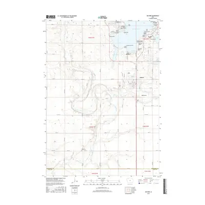
2015 Map of Milford
USGS Topo · Published 2015About this map
West Okoboji Lake and its many distinctive shorelines, from Breezy Point to Pillsbury Point, dominate the northeastern portion of this Iowa landscape. The resort-oriented character of the shoreline is evident in the dense clusters of beaches such as Sunset Beach, Spencer Beach, and Fillenworth Beach. This recreational density contrasts with the agricultural and riverine terrain to the west and south, where the Little Sioux River meanders through T99N R37W. The settlement of Milford serves as a central hub, flanked by the residential areas of Wahpeton and Arnolds Park. Genealogists and local historians can locate several burial grounds, including the Milford Cem and Little Sioux Lutheran Cem, which represent the early community foundations in Dickinson Co. South of the main town, the area known as Old Town and the proximity of Fuller Airport mark the continued evolution of the region's transport and settlement patterns.
Find a feature on this map
73 named features on this map. Tap any name to fly to it.
Don’t see what you’re looking for? This feature index may not catch every label — zoom into the map to look around manually.
Map Details
Editions of this 2015 Milford Map
This is the sole edition of this map. No revisions or reprints were ever made.
Other maps of this area

1954 · Fairmont
USGS Topo · 1:250,000

1958 · Fairmont
USGS Topo · 1:250,000

1966 · Spencer
USGS Topo · 1:24,000

1966 · Dickens
USGS Topo · 1:24,000

1970 · Milford
USGS Topo · 1:24,000

1970 · Everly
USGS Topo · 1:24,000

1970 · Okoboji
USGS Topo · 1:24,000

1970 · Spirit Lake SE
USGS Topo · 1:24,000

1970 · Lake Park SE
USGS Topo · 1:24,000

1970 · Spirit Lake
USGS Topo · 1:24,000