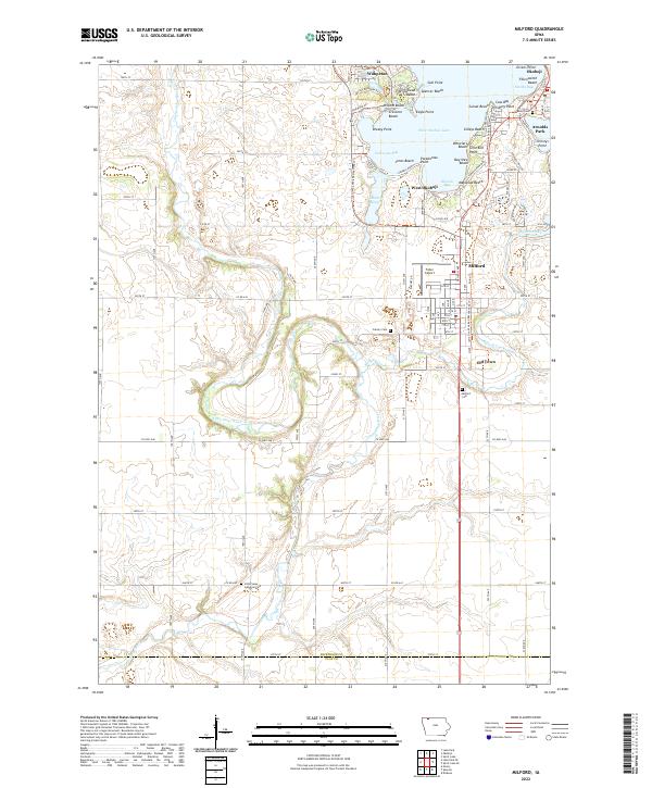
2022 Map of Milford
USGS Topo · Published 2022About this map
Milford serves as a central hub on this map, situated where Milford Creek exits the southern end of the Iowa Great Lakes region. The landscape is defined by the contrast between the dense residential and recreational developments along West Okoboji Lake and the winding course of the Little Sioux River to the west. The lakefront is a complex patchwork of named points and beaches, including Pillsbury Point and Gull Point, reflecting a long history of seasonal and permanent settlement.
Find a feature on this map
77 named features on this map. Tap any name to fly to it.
Don’t see what you’re looking for? This feature index may not catch every label — zoom into the map to look around manually.
Map Details
Editions of this 2022 Milford Map
This is the sole edition of this map. No revisions or reprints were ever made.
Other maps of this area

1954 · Fairmont
USGS Topo · 1:250,000

1958 · Fairmont
USGS Topo · 1:250,000

1966 · Spencer
USGS Topo · 1:24,000

1966 · Dickens
USGS Topo · 1:24,000

1970 · Milford
USGS Topo · 1:24,000

1970 · Everly
USGS Topo · 1:24,000

1970 · Okoboji
USGS Topo · 1:24,000

1970 · Spirit Lake SE
USGS Topo · 1:24,000

1970 · Lake Park SE
USGS Topo · 1:24,000

1970 · Spirit Lake
USGS Topo · 1:24,000