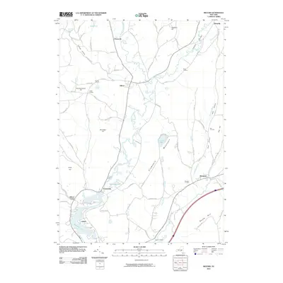
2010 Map of Milford
USGS Topo · Published 2010About this map
The Susquehanna River winds through the heart of this Susquehanna Valley landscape, defining the corridor between the steep rise of Crumhorn Mountain and the western hills. The village of Milford serves as a central point along the river, flanked by smaller hamlets and historical corners such as Portlandville, Westville, and Edson Corners. The southern portion of the map is dominated by the waters of Goodyear Lake at Cliffside, where the river broadens into a significant reservoir.
Find a feature on this map
75 named features on this map. Tap any name to fly to it.
Don’t see what you’re looking for? This feature index may not catch every label — zoom into the map to look around manually.
Map Details
Editions of this 2010 Milford Map
This is the sole edition of this map. No revisions or reprints were ever made.
Other maps of this area

1907 · Cooperstown
USGS Topo · 1:62,500

1909 · Cooperstown
USGS Topo · 1:62,500

1909 · Delhi
USGS Topo · 1:62,500

1910 · Hartwick
USGS Topo · 1:62,500

1911 · Delhi
USGS Topo · 1:62,500

1912 · Hartwick
USGS Topo · 1:62,500

1915 · Oneonta
USGS Topo · 1:62,500

1918 · Oneonta
USGS Topo · 1:62,500

1943 · Mt Vision
USGS Topo · 1:24,000

1943 · Milford
USGS Topo · 1:24,000