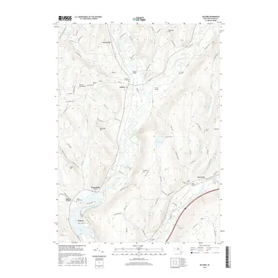
2016 Map of Milford
USGS Topo · Published 2016About this map
The Susquehanna River carves a deep valley through Otsego County, anchoring a landscape where agricultural plateaus meet riparian corridors. Settlements like Milford and Portlandville are clustered along the river and its major tributaries, including Cherry Valley Creek and Schenevus Creek. The topography is defined by high ridges such as Crumhorn Mtn and Burying Ground Hill, which separate the primary river valley from smaller upland hollows like Hinman Hollow. At the southern edge, the river widens into Goodyear Lake near the community of Cliffside. Genealogists will find a high density of burial sites across the township, from the central Milford Village Cem to smaller family or community plots like Sherman Cem and Platt Cem, which remain as markers of early settlement patterns in this part of central New York.
Find a feature on this map
95 named features on this map. Tap any name to fly to it.
Don’t see what you’re looking for? This feature index may not catch every label — zoom into the map to look around manually.
Map Details
Editions of this 2016 Milford Map
This is the sole edition of this map. No revisions or reprints were ever made.
Other maps of this area

1907 · Cooperstown
USGS Topo · 1:62,500

1909 · Cooperstown
USGS Topo · 1:62,500

1909 · Delhi
USGS Topo · 1:62,500

1910 · Hartwick
USGS Topo · 1:62,500

1911 · Delhi
USGS Topo · 1:62,500

1912 · Hartwick
USGS Topo · 1:62,500

1915 · Oneonta
USGS Topo · 1:62,500

1918 · Oneonta
USGS Topo · 1:62,500

1943 · Mt Vision
USGS Topo · 1:24,000

1943 · Milford
USGS Topo · 1:24,000