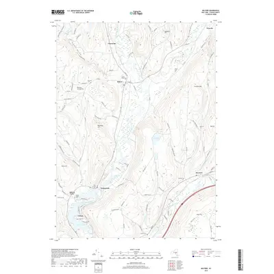
2019 Map of Milford
USGS Topo · Published 2019About this map
The Susquehanna River winds southward through the center of this terrain, anchoring a corridor of valley settlements in Otsego County. Established villages and hamlets including Milford, Portlandville, and Maryland trace the river's path and its tributaries like Cherry Valley Creek and Schenevus Creek. The landscape is defined by significant elevations such as Crumhorn Mtn and Eggleston Hill, which overlook a series of upland water bodies including Crumhorn Lake and Saddlebag Lake. For those researching local lineages, the map identifies numerous burial sites from the central Milford Village Cem to the outlying Waters Cem and Maryland Cem. Evidence of local industry appears at the Gravel Bank north of Milford, while the southern reach of the survey is dominated by the waters of Goodyear Lake near Cliffside.
Find a feature on this map
97 named features on this map. Tap any name to fly to it.
Don’t see what you’re looking for? This feature index may not catch every label — zoom into the map to look around manually.
Map Details
Editions of this 2019 Milford Map
This is the sole edition of this map. No revisions or reprints were ever made.
Other maps of this area

1907 · Cooperstown
USGS Topo · 1:62,500

1909 · Cooperstown
USGS Topo · 1:62,500

1909 · Delhi
USGS Topo · 1:62,500

1910 · Hartwick
USGS Topo · 1:62,500

1911 · Delhi
USGS Topo · 1:62,500

1912 · Hartwick
USGS Topo · 1:62,500

1915 · Oneonta
USGS Topo · 1:62,500

1918 · Oneonta
USGS Topo · 1:62,500

1943 · Mt Vision
USGS Topo · 1:24,000

1943 · Milford
USGS Topo · 1:24,000