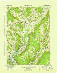
1945 Map of Milford
USGS Topo · Published 1945About this map
Crumhorn Mountain dominates the central landscape of this Otsego County survey, situated between the valleys of the Susquehanna River and Schenevus Creek. The map records a series of upland settlements and family landmarks during the mid-1940s, including Edson Corners and Clintonville. Local history is deeply embedded in the terrain through named cemeteries such as Sherman Cem, Waters Cem, and the simple designation of a Burying Ground near the Hartwick border.
Find a feature on this map
38 named features on this map. Tap any name to fly to it.
Don’t see what you’re looking for? This feature index may not catch every label — zoom into the map to look around manually.
Map Details
Editions of this 1945 Milford Map
This is the sole edition of this map. No revisions or reprints were ever made.
Other maps of this area

1907 · Cooperstown
USGS Topo · 1:62,500

1909 · Cooperstown
USGS Topo · 1:62,500

1909 · Delhi
USGS Topo · 1:62,500

1910 · Hartwick
USGS Topo · 1:62,500

1911 · Delhi
USGS Topo · 1:62,500

1912 · Hartwick
USGS Topo · 1:62,500

1915 · Oneonta
USGS Topo · 1:62,500

1918 · Oneonta
USGS Topo · 1:62,500

1943 · Mt Vision
USGS Topo · 1:24,000

1943 · Milford
USGS Topo · 1:24,000