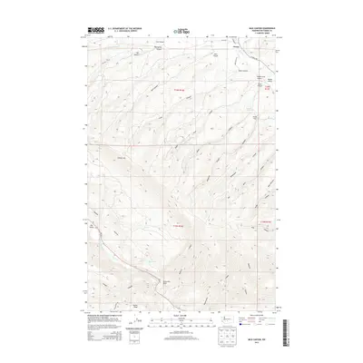
2014 Map of Milk Canyon
USGS Topo · Published 2014About this map
Cleman Mtn dominates this Yakima County landscape, where the high ridges of the Cascades transition toward the valleys of central Washington. The northern portion of the map is defined by the Wenas Valley and the small settlement of Wenas, situated at the intersection of Maloy RD and N Wenas RD. This area shows a complex drainage system where the S Fork Wenas Cr and Wenas Cr flow through a series of named canyons like Evans Canyon and Milk Canyon. To the southwest, the Naches River carves a dramatic path through Horseshoe Bend near the Nile Valley. The presence of several named flats and springs, such as Fisher Flat and Sandstone Spring, suggests a history of localized grazing and water management in this high-elevation terrain, while Bethel Ridge RD marks the southern high ground near Bethel Ridge.
Find a feature on this map
43 named features on this map. Tap any name to fly to it.
Don’t see what you’re looking for? This feature index may not catch every label — zoom into the map to look around manually.
Map Details
Editions of this 2014 Milk Canyon Map
This is the sole edition of this map. No revisions or reprints were ever made.
Other maps of this area

1899 · Ellensburg
USGS Topo · 1:125,000

1901 · Ellensburg
USGS Topo · 1:125,000

1950 · Yakima
USGS Topo · 1:250,000

1958 · Ellensburg
USGS Topo · 1:62,500

1958 · Naches
USGS Topo · 1:24,000

1958 · Yakima
USGS Topo · 1:250,000

1961 · Yakima
USGS Topo · 1:250,000

1971 · Nile
USGS Topo · 1:24,000
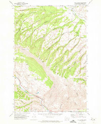
1971 · Milk Canyon
USGS Topo · 1:24,000
1971 · Hudson Creek
USGS Topo · 1:24,000