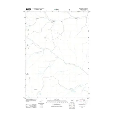
2012 Map of Milk Creek
USGS Topo · Published 2012About this map
L U Cow Camp and T A Cow Camp anchor this 2012 survey of the high desert and range lands in Hot Springs County. The landscape is defined by a complex network of seasonal drainage and creek beds, most notably Cottonwood Cr and Grass Cr. These waterways are flanked by numerous named draws such as Raspberry Draw and Sanford Draw, illustrating the erosional character of the region. Evidence of local industry and recreational use is visible through landmarks like the Anderson Sawmill and the Dvarishkis Hunting Camp.
Find a feature on this map
27 named features on this map. Tap any name to fly to it.
Don’t see what you’re looking for? This feature index may not catch every label — zoom into the map to look around manually.
Map Details
Editions of this 2012 Milk Creek Map
This is the sole edition of this map. No revisions or reprints were ever made.
Other maps of this area

1904 · Kirwin
USGS Topo · 1:125,000

1906 · Kirwin
USGS Topo · 1:125,000

1955 · Thermopolis
USGS Topo · 1:250,000

1956 · Milk Creek
USGS Topo · 1:24,000

1956 · Twentyone Creek
USGS Topo · 1:24,000

1956 · Soapy Dale Peak
USGS Topo · 1:24,000

1956 · Adam Weiss Peak
USGS Topo · 1:24,000

1958 · Thermopolis
USGS Topo · 1:250,000

1962 · Thermopolis
USGS Topo · 1:250,000
1965 · Eagle Nest Ranch
USGS Topo · 1:24,000