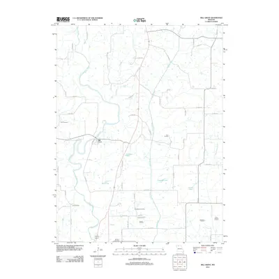
2012 Map of Mill Grove
USGS Topo · Published 2012About this map
Mill Grove serves as the primary focal point in this portion of Grundy County, situated along a sharp bend of the Weldon River. The surrounding landscape is characterized by a high concentration of family and community burial sites, which provide significant data for genealogical research. Notable locations include Salem Cemetery to the west and the clustered Middleberry Cemetery, Wyatt Cemetery, and Trussell Cemetery to the south. The hydrography is defined by numerous north-south waterways, including Cain Branch and Muddy Creek, which feed into larger bodies such as Crowder Lake and Whitt Lake. This network of small streams and named lakes, such as Constable Lake and Akers Lake, suggests a rural economy tied closely to the drainage patterns of the Missouri plains.
Find a feature on this map
60 named features on this map. Tap any name to fly to it.
Don’t see what you’re looking for? This feature index may not catch every label — zoom into the map to look around manually.
Map Details
Editions of this 2012 Mill Grove Map
This is the sole edition of this map. No revisions or reprints were ever made.
Other maps of this area

1946 · Princeton
USGS Topo · 1:62,500

1946 · Galt
USGS Topo · 1:62,500

1948 · Princeton
USGS Topo · 1:62,500

1948 · Trenton
USGS Topo · 1:62,500

1949 · Galt
USGS Topo · 1:62,500

1954 · Centerville
USGS Topo · 1:250,000

1957 · Centerville
USGS Topo · 1:250,000

1958 · Centerville
USGS Topo · 1:250,000

1964 · Ravanna
USGS Topo · 1:24,000

1964 · Half Rock
USGS Topo · 1:24,000