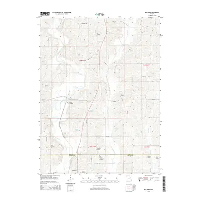
2014 Map of Mill Grove
USGS Topo · Published 2014About this map
Weldon River meanders through this agricultural region of northern Missouri, tracing a path south past the settlement of Mill Grove. The landscape is defined by the winding waters of Muddy Creek and W Honey Cr, interspersed with several small reservoirs including Crowder Lake, Whitt Lake, and Constable Lake. This survey illustrates the intricate rural road network that connects isolated farmsteads across the Mercer and Grundy county line, featuring several family-named landmarks such as Wyatt Cemetery and Groff Cemetery. Near the southern map edge, the town of Spickard serves as a local hub, anchored by the nearby Spickard Cemetery. The map detail preserves the exact spatial relationship between early 21st-century property boundaries and the enduring natural watercourses that have historically shaped this farming community.
Find a feature on this map
60 named features on this map. Tap any name to fly to it.
Don’t see what you’re looking for? This feature index may not catch every label — zoom into the map to look around manually.
Map Details
Editions of this 2014 Mill Grove Map
This is the sole edition of this map. No revisions or reprints were ever made.
Other maps of this area

1946 · Princeton
USGS Topo · 1:62,500

1946 · Galt
USGS Topo · 1:62,500

1948 · Princeton
USGS Topo · 1:62,500

1948 · Trenton
USGS Topo · 1:62,500

1949 · Galt
USGS Topo · 1:62,500

1954 · Centerville
USGS Topo · 1:250,000

1957 · Centerville
USGS Topo · 1:250,000

1958 · Centerville
USGS Topo · 1:250,000

1964 · Ravanna
USGS Topo · 1:24,000

1964 · Half Rock
USGS Topo · 1:24,000