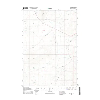
2014 Map of Mill Point
USGS Topo · Published 2014About this map
Grasshopper Valley serves as the focal point of this Beaverhead County landscape, where the confluence of numerous drainages reflects a classic Montana high-country water system. The topographic prominence of Mill Point overlooks a network of historical transit routes, including Bannack Rd and Horse Prairie-Bannack Rd, which connect this area to the broader territorial history of the region. The map provides specific locational data for researchers interested in the legacy of early settlements, most notably marking the Bannack Cem on the eastern edge of the valley. Riparian corridors like Grasshopper Cr, Reservoir Cr, and Sagebrush Cr crisscross the terrain, illustrating the critical role of water management and natural forage in this part of the state. The layout of section lines and township boundaries such as t7s r12w and t8s r12w further documents the structured land division that has governed this ranching and mining country for generations.
Find a feature on this map
25 named features on this map. Tap any name to fly to it.
Don’t see what you’re looking for? This feature index may not catch every label — zoom into the map to look around manually.
Map Details
Editions of this 2014 Mill Point Map
This is the sole edition of this map. No revisions or reprints were ever made.
Other maps of this area

1893 · Dillon
USGS Topo · 1:250,000

1952 · Bannack
USGS Topo · 1:24,000

1952 · Eli Spring
USGS Topo · 1:24,000

1952 · Ermont
USGS Topo · 1:24,000

1955 · Dillon
USGS Topo · 1:250,000

1957 · Dillon
USGS Topo · 1:250,000

1958 · Dillon
USGS Topo · 1:250,000

1959 · Polaris
USGS Topo · 1:62,500

1959 · Grant
USGS Topo · 1:62,500

1962 · Dillon
USGS Topo · 1:250,000