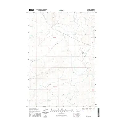
2017 Map of Mill Point
USGS Topo · Published 2017About this map
Mill Point dominates the northern elevation of this landscape, overlooking a complex drainage network that defines the region’s topography. The area is marked by a series of creeks, including Grasshopper Creek, Sagebrush Cr, and Buffalo Cr, which carve through the high country. Human presence is concentrated along a network of remote access routes such as Bannack Rd and Bannack Bench Rd, which navigate the rises and falls of the high plains. The most significant historical marker on the sheet is the Bannack Cem, situated near the eastern edge. This site provides a vital connection to the early residents of Beaverhead County, preserved amidst the ranching and mountainous terrain that has seen centuries of movement along corridors like Rocky Hills Rd 1827 and Reservoir Creek Rd.
Find a feature on this map
24 named features on this map. Tap any name to fly to it.
Don’t see what you’re looking for? This feature index may not catch every label — zoom into the map to look around manually.
Map Details
Editions of this 2017 Mill Point Map
This is the sole edition of this map. No revisions or reprints were ever made.
Other maps of this area

1893 · Dillon
USGS Topo · 1:250,000

1952 · Bannack
USGS Topo · 1:24,000

1952 · Eli Spring
USGS Topo · 1:24,000

1952 · Ermont
USGS Topo · 1:24,000

1955 · Dillon
USGS Topo · 1:250,000

1957 · Dillon
USGS Topo · 1:250,000

1958 · Dillon
USGS Topo · 1:250,000

1959 · Polaris
USGS Topo · 1:62,500

1959 · Grant
USGS Topo · 1:62,500

1962 · Dillon
USGS Topo · 1:250,000