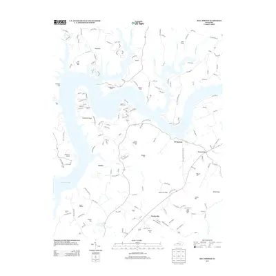
2013 Map of Mill Springs
USGS Topo · Published 2013About this map
Lake Cumberland dominates this northern Wayne County landscape, its sprawling shoreline creating a complex series of inlets and points like Cumberland Point and Onion Point. The map illustrates the modern recreational character of the waterway at Conley Bottom Dock, while also preserving the historic inland settlements of Mill Springs and Steubenville. These communities are connected by a network of rural roads that traverse the elevated terrain of Cumberland Ridge and Betsey Ridge. Numerous small family and community burial grounds, including Norman Cem, Dodson Cem, and Sloan Cem, are scattered across the uplands, offering significant points of interest for genealogical research. The topography is defined by prominent heights like Little Hannah Hill and Rankin Knob, which overlook the deep hollows and creek beds that feed into the reservoir.
Find a feature on this map
161 named features on this map. Tap any name to fly to it.
Don’t see what you’re looking for? This feature index may not catch every label — zoom into the map to look around manually.
Map Details
Editions of this 2013 Mill Springs Map
This is the sole edition of this map. No revisions or reprints were ever made.
Other maps of this area

1911 · Monticello
USGS Topo · 1:62,500

1914 · Monticello
USGS Topo · 1:62,500

1932 · Burnside
USGS Topo · 1:62,500

1935 · Somerset
USGS Topo · 1:62,500

1953 · Frazer
USGS Topo · 1:24,000

1953 · Parnell
USGS Topo · 1:24,000

1953 · Monticello
USGS Topo · 1:24,000

1953 · Mill Springs
USGS Topo · 1:24,000

1954 · Jabez
USGS Topo · 1:24,000

1954 · Coopersville
USGS Topo · 1:24,000