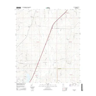
2015 Map of Millard
USGS Topo · Published 2015About this map
The community of Millard sits at the intersection of local routes and the modern highway corridor, serving as a primary point of reference in southern Mississippi. The landscape is defined by the winding passage of E Hobolochitto Cr, which flows southward through the center of the region toward Anchor Lake. This water system is supported by numerous tributaries including Jumpoff Cr, Cypress Cr, and Stanfield Cr, creating a complex network of wetlands and drainage basins.
Find a feature on this map
82 named features on this map. Tap any name to fly to it.
Don’t see what you’re looking for? This feature index may not catch every label — zoom into the map to look around manually.
Map Details
Editions of this 2015 Millard Map
This is the sole edition of this map. No revisions or reprints were ever made.
Other maps of this area

1953 · Mobile
USGS Topo · 1:250,000

1955 · Savannah
USGS Topo · 1:62,500

1957 · Mobile
USGS Topo · 1:250,000

1958 · Carnes
USGS Topo · 1:62,500

1958 · Picayune
USGS Topo · 1:62,500

1959 · Poplarville
USGS Topo · 1:62,500

1960 · Mobile
USGS Topo · 1:250,000

1963 · Mobile
USGS Topo · 1:250,000

1965 · Mobile
USGS Topo · 1:250,000
1982 · Necaise
USGS Topo · 1:24,000