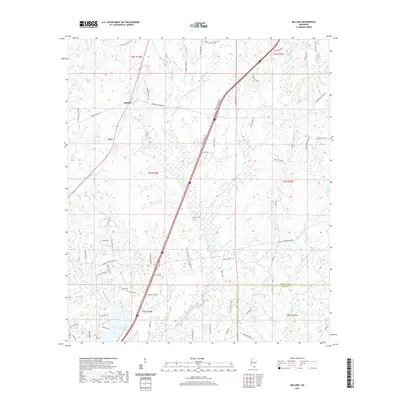
2021 Map of Millard
USGS Topo · Published 2021About this map
Millard and Tyler anchor this landscape in Pearl River County, where the terrain is defined by the winding drainages of Catahoula Cr and E Hobolochitto Cr. The map reveals a community structured around family-named infrastructure, such as Savannah Millard Rd and Argile Smith Rd, reflecting deep-rooted land ownership patterns. This modern survey shows the continuity of historical sites alongside newer developments, notably Anchor Lake in the southern reaches.
Find a feature on this map
75 named features on this map. Tap any name to fly to it.
Don’t see what you’re looking for? This feature index may not catch every label — zoom into the map to look around manually.
Map Details
Editions of this 2021 Millard Map
This is the sole edition of this map. No revisions or reprints were ever made.
Other maps of this area

1953 · Mobile
USGS Topo · 1:250,000

1955 · Savannah
USGS Topo · 1:62,500

1957 · Mobile
USGS Topo · 1:250,000

1958 · Carnes
USGS Topo · 1:62,500

1958 · Picayune
USGS Topo · 1:62,500

1959 · Poplarville
USGS Topo · 1:62,500

1960 · Mobile
USGS Topo · 1:250,000

1963 · Mobile
USGS Topo · 1:250,000

1965 · Mobile
USGS Topo · 1:250,000
1982 · Necaise
USGS Topo · 1:24,000