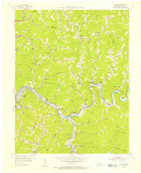
1954 Map of Millard
USGS Topo · Published 1956About this map
The Levisa Fork carves a winding path through the deep valleys of Pike County, serving as the primary corridor for settlement and transit in the mid-1950s. Communities such as Shelbiana and Millard follow the river's bends, connected by the Chesapeake and Ohio railroad and a network of mountain roads. The geography is characterized by numerous hollows and branches, including Raccoon Creek and Pompey Branch, each supporting small clusters of homes, rural schools like the Jonican Sch, and country churches such as Philadelphia Ch.
Find a feature on this map
102 named features on this map. Tap any name to fly to it.
Don’t see what you’re looking for? This feature index may not catch every label — zoom into the map to look around manually.
Map Details
Editions of this 1954 Millard Map
This is the sole edition of this map. No revisions or reprints were ever made.
Other maps of this area

1886 · Prestonsburg
USGS Topo · 1:125,000

1886 · Grundy
USGS Topo · 1:125,000

1887 · Warfield
USGS Topo · 1:125,000

1890 · Whitesburg
USGS Topo · 1:125,000

1890 · Grundy
USGS Topo · 1:125,000

1891 · Warfield
USGS Topo · 1:125,000

1892 · Grundy
USGS Topo · 1:125,000

1892 · Whitesburg
USGS Topo · 1:125,000

1892 · Prestonsburg
USGS Topo · 1:125,000

1914 · Laynesville
USGS Topo · 1:48,000