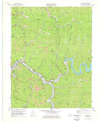
1978 Map of Millard
USGS Topo · Published 1979About this map
Fishtrap Lake and the Fishtrap Dam dominate the eastern landscape of this late-1970s Pike County survey. The Levisa Fork and Russell Fork serve as the primary geographical arteries, with the Chesapeake and Ohio railroad following the river bends to service the region's dense industrial infrastructure. Evidence of the coal economy is pervasive, indicated by numerous strip mines and industrial waste ponds that punctuate the hillsides above the river valleys.
Find a feature on this map
80 named features on this map. Tap any name to fly to it.
Don’t see what you’re looking for? This feature index may not catch every label — zoom into the map to look around manually.
Map Details
Editions of this 1978 Millard Map
This is the sole edition of this map. No revisions or reprints were ever made.
Other maps of this area

1886 · Prestonsburg
USGS Topo · 1:125,000

1886 · Grundy
USGS Topo · 1:125,000

1887 · Warfield
USGS Topo · 1:125,000

1890 · Whitesburg
USGS Topo · 1:125,000

1890 · Grundy
USGS Topo · 1:125,000

1891 · Warfield
USGS Topo · 1:125,000

1892 · Grundy
USGS Topo · 1:125,000

1892 · Whitesburg
USGS Topo · 1:125,000

1892 · Prestonsburg
USGS Topo · 1:125,000

1914 · Laynesville
USGS Topo · 1:48,000