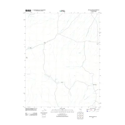
2012 Map of Miller Canyon
USGS Topo · Published 2012About this map
Mud Springs serves as a focal point in this high-desert landscape of eastern Nevada, where water sources dictate the patterns of human activity. The map reveals a network of vital water points scattered throughout the terrain, from Coyote Spring and Rattlesnake Spring to the higher elevations of Upper Burnt Canyon Spring. These springs and seasonal drainages like Burnt Canyon Creek and Cobb Creek support the area's ranching heritage, evidenced by the presence of the Delmue Ranch and Johnson Ranch. The topographic detail highlights the way the land is carved into distinct features such as Mutton Hollow and Coyote Canyon, illustrating the varied relief of Miller Canyon. This 2012 survey captures a snapshot of a working landscape where traditional ranching operations and water management, including the Millard Canyon Reservoir, remain central to the local geography of Lincoln County.
Find a feature on this map
22 named features on this map. Tap any name to fly to it.
Don’t see what you’re looking for? This feature index may not catch every label — zoom into the map to look around manually.
Map Details
Editions of this 2012 Miller Canyon Map
This is the sole edition of this map. No revisions or reprints were ever made.
Other maps of this area

1956 · Lund
USGS Topo · 1:250,000

1960 · Lund
USGS Topo · 1:250,000

1970 · Parsnip Peak
USGS Topo · 1:24,000

1972 · Gleason Basin
USGS Topo · 1:24,000

1972 · Rosencrans Knolls
USGS Topo · 1:24,000

1972 · Hamlin Well
USGS Topo · 1:24,000

1972 · White Rock Peak
USGS Topo · 1:24,000

1972 · Buck Wash Well
USGS Topo · 1:24,000

1972 · Miller Canyon
USGS Topo · 1:24,000

1973 · Atlanta
USGS Topo · 1:24,000