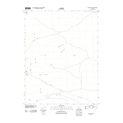
2010 Map of Miller Cove
USGS Topo · Published 2010About this map
Sawtooth Mountain dominates this portion of the House Range in Millard County, Utah. The landscape is defined by its complex drainage network, where Little Horse Canyon and Big Horse Canyon cut through the terrain toward the Badlands to the east. Historically, human activity in this arid environment focused on extraction and transit, evidenced by the Klondike Mine situated near the western edge of the range. Access across this topography follows established routes like Miller Canyon Rd, which traces the winding path of Miller Canyon toward Miller Cove. This survey preserves the spatial relationship between these remote landmarks and the named ridges and canyons such as Orr Ridge and Candland Canyon, providing a clear record of the area's geological and industrial markers as they were recognized in the early 21st century.
Find a feature on this map
18 named features on this map. Tap any name to fly to it.
Don’t see what you’re looking for? This feature index may not catch every label — zoom into the map to look around manually.
Map Details
Editions of this 2010 Miller Cove Map
This is the sole edition of this map. No revisions or reprints were ever made.
Other maps of this area

1908 · Fish Springs
USGS Topo · 1:250,000

1910 · Fish Springs
USGS Topo · 1:250,000

1953 · Delta
USGS Topo · 1:250,000

1958 · Delta
USGS Topo · 1:250,000

1960 · Notch Peak
USGS Topo · 1:62,500

1962 · Delta
USGS Topo · 1:250,000

1972 · Whirlwind Valley SW
USGS Topo · 1:24,000

1972 · Swasey Peak SW
USGS Topo · 1:24,000

1972 · Long Ridge Reservoir
USGS Topo · 1:24,000
1972 · Marjum Pass
USGS Topo · 1:24,000