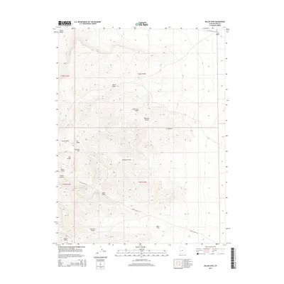
2014 Map of Miller Cove
USGS Topo · Published 2014About this map
The House Range dominates this corner of Millard County, where steep drainage networks and high ridges define a desert landscape of stark relief. Access to this territory is provided by the Miller Canyon Rd and the northern stretch of Old Highway 6 & 50 Rd, which navigate the transitions between high points like Sawtooth Mtn and the low-lying Miller Cove. The map documents a complex system of water-carved features, including Marjum Canyon and Contact Canyon, illustrating how the arid climate and geology have sculpted the terrain into distinct zones such as the Badlands. For those tracking geographic markers, named high ground like Orr Ridge and Kells Knolls provides fixed points across the varied elevations of Amasa Valley.
Find a feature on this map
23 named features on this map. Tap any name to fly to it.
Don’t see what you’re looking for? This feature index may not catch every label — zoom into the map to look around manually.
Map Details
Editions of this 2014 Miller Cove Map
This is the sole edition of this map. No revisions or reprints were ever made.
Other maps of this area

1908 · Fish Springs
USGS Topo · 1:250,000

1910 · Fish Springs
USGS Topo · 1:250,000

1953 · Delta
USGS Topo · 1:250,000

1958 · Delta
USGS Topo · 1:250,000

1960 · Notch Peak
USGS Topo · 1:62,500

1962 · Delta
USGS Topo · 1:250,000

1972 · Whirlwind Valley SW
USGS Topo · 1:24,000

1972 · Swasey Peak SW
USGS Topo · 1:24,000

1972 · Long Ridge Reservoir
USGS Topo · 1:24,000
1972 · Marjum Pass
USGS Topo · 1:24,000