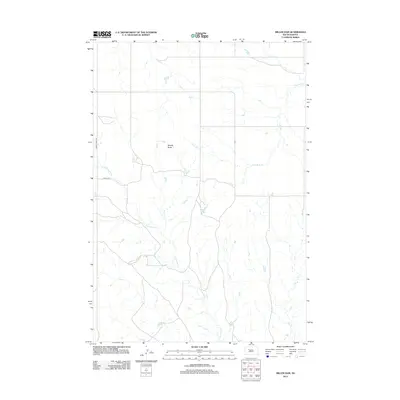
2012 Map of Miller Dam
USGS Topo · Published 2012About this map
Marple Butte rises as a distinct landmark within the vast ranching and rangeland of Ziebach County. This 2012 survey by the U. S. Geological Survey illustrates the importance of water management in this arid stretch of South Dakota, centered on the Miller Dam reservoir. The drainage patterns of Little Bear Cr and Cottonwood Cr dominate the local topography, carving paths through the open plains. Grounded in data from the National Hydrography and Elevation Datasets, the map provides a precise layout of the rural transportation network, anchored by Cherry Creek Rd and Farlee Rd. These corridors remain vital for connecting isolated agricultural holdings and managing the expansive landscape of District 2.
Find a feature on this map
6 named features on this map. Tap any name to fly to it.
Don’t see what you’re looking for? This feature index may not catch every label — zoom into the map to look around manually.
Map Details
Editions of this 2012 Miller Dam Map
This is the sole edition of this map. No revisions or reprints were ever made.
Other maps of this area

1953 · McIntosh
USGS Topo · 1:250,000

1954 · Pierre
USGS Topo · 1:250,000

1958 · Pierre
USGS Topo · 1:250,000

1958 · McIntosh
USGS Topo · 1:250,000

1979 · Dupree
USGS Topo · 1:25,000

1981 · Lantry
USGS Topo · 1:24,000

1981 · High Elk Hill NW
USGS Topo · 1:24,000

1981 · High Elk Hill SW
USGS Topo · 1:24,000

1982 · Miller Dam
USGS Topo · 1:24,000

1982 · Longbrake Ranch
USGS Topo · 1:24,000