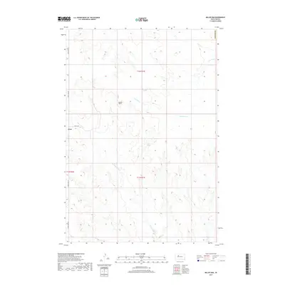
2017 Map of Miller Dam
USGS Topo · Published 2017About this map
Marple Butte rises above the drainage systems of Ziebach County in this western South Dakota landscape. The map centers on a region defined by the winding paths of Little Bear Cr and Cottonwood Cr, illustrating the rugged topography of the High Plains. The small settlement of Chase sits along the western edge, positioned near the intersection of Cherry Creek Rd and Farlee Way. This 2017 survey reflects a contemporary view of the area's rural infrastructure and hydrology, specifically highlighting the namesake Miller Dam situated in the central portion of the quadrangle. The land is organized by the Public Land Survey System, with township boundaries for t12n r21e and t11n r21e providing a structural framework for researchers tracing local property or ranching history.
Find a feature on this map
11 named features on this map. Tap any name to fly to it.
Don’t see what you’re looking for? This feature index may not catch every label — zoom into the map to look around manually.
Map Details
Editions of this 2017 Miller Dam Map
This is the sole edition of this map. No revisions or reprints were ever made.
Other maps of this area

1953 · McIntosh
USGS Topo · 1:250,000

1954 · Pierre
USGS Topo · 1:250,000

1958 · Pierre
USGS Topo · 1:250,000

1958 · McIntosh
USGS Topo · 1:250,000

1979 · Dupree
USGS Topo · 1:25,000

1981 · Lantry
USGS Topo · 1:24,000

1981 · High Elk Hill NW
USGS Topo · 1:24,000

1981 · High Elk Hill SW
USGS Topo · 1:24,000

1982 · Miller Dam
USGS Topo · 1:24,000

1982 · Longbrake Ranch
USGS Topo · 1:24,000