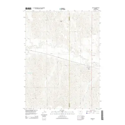
2014 Map of Miller
USGS Topo · Published 2014About this map
Miller serves as the central hub of this Nebraska landscape, situated at the intersection of Us-183 and Ne-40. The topography is defined by the winding course of the Wood River, which cuts across the central portion of the map, and the branching drainage of Cherry Valley Cr to the south. This area demonstrates a highly organized rural infrastructure, with a dense grid of section roads like Road 448 and Road 449 providing access to the expansive agricultural terrain. To the north, Wild Horse Valley adds variation to the landform, while the Armada Cem north of the town center offers a specific point of interest for genealogists and local historians. Man-made water features such as School Land Reservoir Number 3 and Judy Reservoir reflect the region's managed water resources, supporting the local farming and ranching economy that defines this part of Buffalo County.
Find a feature on this map
33 named features on this map. Tap any name to fly to it.
Don’t see what you’re looking for? This feature index may not catch every label — zoom into the map to look around manually.
Map Details
Editions of this 2014 Miller Map
This is the sole edition of this map. No revisions or reprints were ever made.
Other maps of this area

1896 · Lexington
USGS Topo · 1:125,000

1896 · Kearney
USGS Topo · 1:125,000

1899 · Lexington
USGS Topo · 1:125,000

1951 · Mason City SW
USGS Topo · 1:24,000

1951 · Eddyville
USGS Topo · 1:24,000

1951 · Mason City SE
USGS Topo · 1:24,000

1955 · Broken Bow
USGS Topo · 1:250,000

1955 · Grand Island
USGS Topo · 1:250,000

1956 · Broken Bow
USGS Topo · 1:250,000

1957 · Grand Island
USGS Topo · 1:250,000