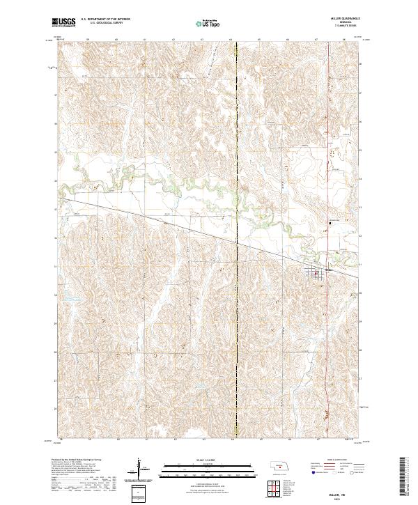
2021 Map of Miller
USGS Topo · Published 2021About this map
The village of Miller serves as a focal point for this section of central Nebraska, situated at the intersection of a grid-iron road network and the undulating terrain of the Platte River valley periphery. To the north of the settlement, Wild Horse Valley carves a natural corridor through the hills, illustrating the geographic patterns that influenced early pioneer routes and subsequent agricultural development. This 2021 survey also documents essential local landmarks such as Armada Cem, located north of the town center, and the School Land Reservoir Number 3 in the western reaches. The map clearly delineates the county line between Dawson Co and Buffalo Co, showing how political boundaries bisect the rural landscape and its network of section-line roads like Arrow Rd and Apache Rd.
Find a feature on this map
23 named features on this map. Tap any name to fly to it.
Don’t see what you’re looking for? This feature index may not catch every label — zoom into the map to look around manually.
Map Details
Editions of this 2021 Miller Map
This is the sole edition of this map. No revisions or reprints were ever made.
Other maps of this area

1896 · Lexington
USGS Topo · 1:125,000

1896 · Kearney
USGS Topo · 1:125,000

1899 · Lexington
USGS Topo · 1:125,000

1951 · Mason City SW
USGS Topo · 1:24,000

1951 · Eddyville
USGS Topo · 1:24,000

1951 · Mason City SE
USGS Topo · 1:24,000

1955 · Broken Bow
USGS Topo · 1:250,000

1955 · Grand Island
USGS Topo · 1:250,000

1956 · Broken Bow
USGS Topo · 1:250,000

1957 · Grand Island
USGS Topo · 1:250,000