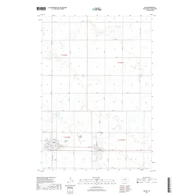
2017 Map of Miller
USGS Topo · Published 2017About this map
Miller and the neighboring community of St. Lawrence anchor this portion of the South Dakota prairie, where the grid-based township system meets the winding hydrology of the Great Plains. The landscape is defined by the subtle drainage of Turtle Creek and its tributaries, including Little Turtle Creek and Ree Creek. These waterways meander through the township lines of t113n r68w, t113n r67w, t112n r68w, and t112n r67w, illustrating the intersection of natural topography and late-19th-century land division.
Find a feature on this map
54 named features on this map. Tap any name to fly to it.
Don’t see what you’re looking for? This feature index may not catch every label — zoom into the map to look around manually.
Map Details
Editions of this 2017 Miller Map
This is the sole edition of this map. No revisions or reprints were ever made.
Other maps of this area

1899 · Redfield
USGS Topo · 1:125,000

1950 · Ree Heights SE
USGS Topo · 1:24,000

1950 · Vayland
USGS Topo · 1:24,000

1950 · Vayland NW
USGS Topo · 1:24,000

1951 · Ree Heights NE
USGS Topo · 1:24,000

1953 · Huron
USGS Topo · 1:250,000

1954 · Huron
USGS Topo · 1:250,000

1966 · Burdette
USGS Topo · 1:24,000

1967 · Miller
USGS Topo · 1:24,000
1967 · Miller SE
USGS Topo · 1:24,000