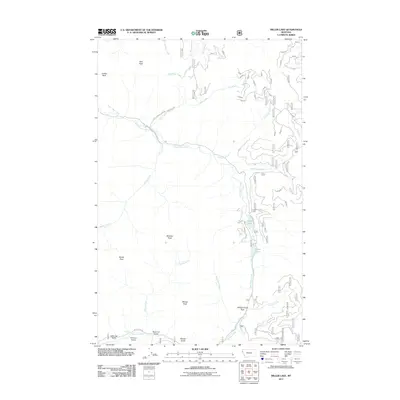
2011 Map of Miller Lake
USGS Topo · Published 2011About this map
Miller Lake and the adjacent Sylvan Lake define the central hydrology of this Montana landscape, where the East Fisher Creek drainage meets the high summits of the Cabinet Mountains. The terrain is marked by prominent elevations including Owl Peak, Jumbo Peak, and Blacktail Peak, while several significant passes like Himes Pass and Willow Creek Pass provide narrow transit corridors through the steep relief. In the southwest, the Vermilion River flows past Vermilion Falls, situated near several small drainages with gold-prospecting history such as Sparrow Gulch and Thirteen Gulch. A network of Forest Service roads, including Natl Forest Develop Road 6754 Rd, provides access into these remote basins, tracing the paths of Colonite Creek and Houghton Creek beneath the shadows of the peaks.
Find a feature on this map
27 named features on this map. Tap any name to fly to it.
Don’t see what you’re looking for? This feature index may not catch every label — zoom into the map to look around manually.
Map Details
Editions of this 2011 Miller Lake Map
This is the sole edition of this map. No revisions or reprints were ever made.
Other maps of this area

1920 · Jennings
USGS Topo · 1:125,000

1935 · Thompson Lakes
USGS Topo · 1:96,000

1937 · Thompson Falls
USGS Topo · 1:125,000

1942 · Thompson Lakes
USGS Topo · 1:125,000

1956 · Wallace
USGS Topo · 1:250,000

1957 · Kalispell
USGS Topo · 1:250,000

1960 · Kalispell
USGS Topo · 1:250,000

1960 · Wallace
USGS Topo · 1:250,000

1961 · Kalispell
USGS Topo · 1:250,000

1966 · Vermilion Peak
USGS Topo · 1:24,000