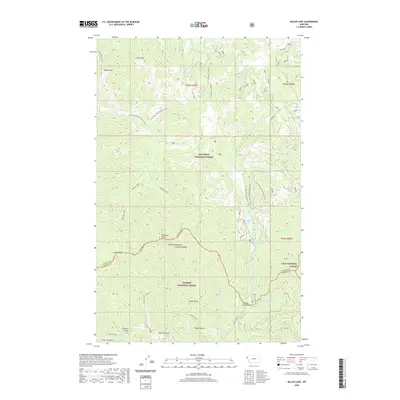
2020 Map of Miller Lake
USGS Topo · Published 2020About this map
Miller Lake and Sylvan Lake sit tucked within the high-elevation drainage of E Fisher Cr, serving as a central focal point for this section of the Cabinet Mountains. This terrain marks the convergence of three major management areas: the Kootenai National Forest, Kaniksu National Forest, and Lolo National Forest. The landscape is defined by steep ridgelines and narrow drainages, including Moose Gulch and Sparrow Gulch, which feed into the Vermilion River at the southern edge of the sheet near Vermilion Falls. Historically significant access routes like Himes Pass and Willow Creek Pass indicate the long-standing importance of these saddles for traversing the divide between Lincoln and Sanders Counties. The map details a network of forest roads and trails, such as the Blacktail Loop, which weave through the high peaks of Owl Peak and Moose Peak.
Find a feature on this map
39 named features on this map. Tap any name to fly to it.
Don’t see what you’re looking for? This feature index may not catch every label — zoom into the map to look around manually.
Map Details
Editions of this 2020 Miller Lake Map
This is the sole edition of this map. No revisions or reprints were ever made.
Other maps of this area

1920 · Jennings
USGS Topo · 1:125,000

1935 · Thompson Lakes
USGS Topo · 1:96,000

1937 · Thompson Falls
USGS Topo · 1:125,000

1942 · Thompson Lakes
USGS Topo · 1:125,000

1956 · Wallace
USGS Topo · 1:250,000

1957 · Kalispell
USGS Topo · 1:250,000

1960 · Kalispell
USGS Topo · 1:250,000

1960 · Wallace
USGS Topo · 1:250,000

1961 · Kalispell
USGS Topo · 1:250,000

1966 · Vermilion Peak
USGS Topo · 1:24,000