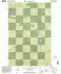
1997 Map of Miller Lake
USGS Topo · Published 2000About this map
Kootenai National Forest and the Kaniksu National Forest dominate this high-altitude landscape along the border of Lincoln and Sanders counties. The topography is defined by significant summits such as Owl Peak, Jumbo Peak, and Blacktail Peak, which overlook a network of drainages including East Fisher Creek and the Vermilion River. High alpine waters are a central feature, with Miller Lake and Sylvan Lake tucked into the eastern ridges below the Cabinet Mountains range line. The map reveals the complex management and access routes within these protected lands, tracing a series of passes and trails like Himes Pass and Willow Creek Pass that connect the steep gulches of Little Joe Gulch and Moose Gulch. This 1990s record captures the wilderness character of the region just before the turn of the millennium, documenting the vital watershed and ridgeline boundaries of western Montana.
Find a feature on this map
26 named features on this map. Tap any name to fly to it.
Don’t see what you’re looking for? This feature index may not catch every label — zoom into the map to look around manually.
Map Details
Editions of this 1997 Miller Lake Map
This is the sole edition of this map. No revisions or reprints were ever made.
Other maps of this area

1920 · Jennings
USGS Topo · 1:125,000

1935 · Thompson Lakes
USGS Topo · 1:96,000

1937 · Thompson Falls
USGS Topo · 1:125,000

1942 · Thompson Lakes
USGS Topo · 1:125,000

1956 · Wallace
USGS Topo · 1:250,000

1957 · Kalispell
USGS Topo · 1:250,000

1960 · Kalispell
USGS Topo · 1:250,000

1960 · Wallace
USGS Topo · 1:250,000

1961 · Kalispell
USGS Topo · 1:250,000

1966 · Vermilion Peak
USGS Topo · 1:24,000