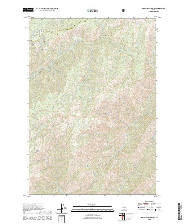
2024 Map of Miller Mountain East
USGS Topo · Published 2024About this map
Boise National Forest encompasses this high-elevation terrain along the border of Valley and Boise counties. The landscape is defined by the significant drainage network of Bear Valley Creek and Clear Creek, which carve through the slopes between peaks like Red Mountain and Miller Mtn. This modern survey reveals a specialized network of forest access routes, including the Lowman-Bear Valley road and the Eastside Road, which serve as the primary conduits for traversing these ridges. The prevalence of established backcountry routes like the Kirkham Ridge Trl and Clear Creek Trl suggests a landscape managed for wilderness access and watershed protection. Historical spur roads, such as Monument Creek Spur 2 and West Elk Horn Cr Spur, indicate the long-standing infrastructure of resource management and exploration in this portion of the Idaho interior.
Find a feature on this map
30 named features on this map. Tap any name to fly to it.
Don’t see what you’re looking for? This feature index may not catch every label — zoom into the map to look around manually.
Map Details
Editions of this 2024 Miller Mountain East Map
This is the sole edition of this map. No revisions or reprints were ever made.
Other maps of this area

1891 · Bear Valley
USGS Topo · 1:125,000

1893 · Bear Valley
USGS Topo · 1:125,000

1909 · Garden Valley
USGS Topo · 1:125,000

1953 · Deadwood Reservoir
USGS Topo · 1:62,500

1957 · Challis
USGS Topo · 1:250,000

1960 · Challis
USGS Topo · 1:250,000

1963 · Challis
USGS Topo · 1:250,000

1972 · Bull Trout Point
USGS Topo · 1:24,000

1972 · Cache Creek
USGS Topo · 1:24,000
1972 · Tyee Mountain
USGS Topo · 1:24,000