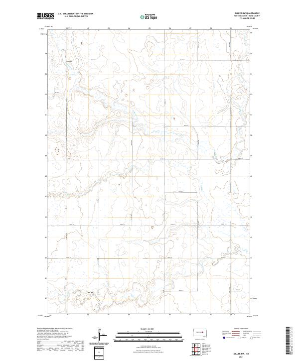
2021 Map of Miller NW
USGS Topo · Published 2021About this map
Wolf Creek and its seasonal tributaries carve a subtle network across this section of Hand County, where the high plains of South Dakota meet the disciplined geometry of the Public Land Survey System. The landscape is defined by the headwaters of Schaefer Cr and Lost Cr, which drain through a mosaic of prairie wetlands and depressions. This map preserves the 2021 arrangement of the rural section-line road network, anchored by primary corridors like Co Rd 17 and Co Rd 11. The sparse human imprint is limited to isolated farmsteads connected by long stretches of gravel roads like 360th Ave and 183rd St. For researchers, this document offers a precise record of late-modern rural land divisions and the hydrological state of the Missouri Plateau's eastern fringe.
Find a feature on this map
25 named features on this map. Tap any name to fly to it.
Don’t see what you’re looking for? This feature index may not catch every label — zoom into the map to look around manually.
Map Details
Editions of this 2021 Miller NW Map
This is the sole edition of this map. No revisions or reprints were ever made.
Other maps of this area

1899 · Redfield
USGS Topo · 1:125,000

1950 · Ree Heights SE
USGS Topo · 1:24,000

1951 · Polo
USGS Topo · 1:24,000

1951 · Ree Heights NE
USGS Topo · 1:24,000

1953 · Huron
USGS Topo · 1:250,000

1954 · Huron
USGS Topo · 1:250,000

1966 · Burdette
USGS Topo · 1:24,000
1966 · Rockham SW
USGS Topo · 1:24,000
1966 · Rockham SE
USGS Topo · 1:24,000

1967 · Miller
USGS Topo · 1:24,000