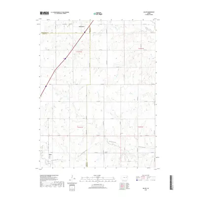
2018 Map of Miller
USGS Topo · Published 2018About this map
Wilmington sits at the northern edge of this landscape, a settlement whose history is preserved at the Wilmington Cem near the junction of Wabaunsee and Lyon counties. Further south, the community of Miller anchors the southwestern corner, situated along the expansive Flint Hills Nature Trail. This path follows a former rail corridor that cuts diagonally across the terrain, illustrating the legacy of transportation in rural Kansas. The area is defined by a network of drainage systems, including Soldier Cr, Salt Cr, and Plum Cr, which carve through the sectional grid of country roads. Local landmarks such as the Rapp Cem and the J V Ranch Airport offer specific points of interest for genealogists and local historians tracking the development of these prairie townships.
Find a feature on this map
36 named features on this map. Tap any name to fly to it.
Don’t see what you’re looking for? This feature index may not catch every label — zoom into the map to look around manually.
Map Details
Editions of this 2018 Miller Map
This is the sole edition of this map. No revisions or reprints were ever made.
Other maps of this area

1885 · Eskridge
USGS Topo · 1:125,000

1889 · Burlingame
USGS Topo · 1:125,000

1889 · Eskridge
USGS Topo · 1:125,000

1894 · Eskridge
USGS Topo · 1:125,000

1894 · Burlingame
USGS Topo · 1:125,000

1947 · Lawrence
USGS Topo · 1:250,000

1950 · Lawrence
USGS Topo · 1:250,000

1952 · Harveyville
USGS Topo · 1:24,000

1952 · Burlingame
USGS Topo · 1:24,000

1955 · Hutchinson
USGS Topo · 1:250,000