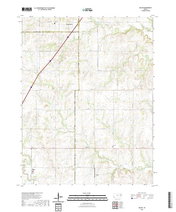
2022 Map of Miller
USGS Topo · Published 2022About this map
Wilmington sits near the northern boundary of this landscape, where the borders of Wabaunsee, Lyon, and Osage counties converge. The terrain is defined by a dense network of drainage, including Soldier Cr, Salt Cr, and Plum Cr, which carve through the rural countryside. To the south, the settlement of Miller is oriented around Main St, serving as a small hub within a grid of section roads. For genealogists and local historians, the presence of Wilmington Cem and Rapp Cem offers vital connection points to early area families and rural congregations. Aviation history is noted by the inclusion of J V Ranch Airport, while several other small waterways like Swede Cr, Smith Cr, and Elm Creek illustrate the natural irrigation that supported the development of these prairie townships.
Find a feature on this map
43 named features on this map. Tap any name to fly to it.
Don’t see what you’re looking for? This feature index may not catch every label — zoom into the map to look around manually.
Map Details
Editions of this 2022 Miller Map
This is the sole edition of this map. No revisions or reprints were ever made.
Other maps of this area

1885 · Eskridge
USGS Topo · 1:125,000

1889 · Burlingame
USGS Topo · 1:125,000

1889 · Eskridge
USGS Topo · 1:125,000

1894 · Eskridge
USGS Topo · 1:125,000

1894 · Burlingame
USGS Topo · 1:125,000

1947 · Lawrence
USGS Topo · 1:250,000

1950 · Lawrence
USGS Topo · 1:250,000

1952 · Harveyville
USGS Topo · 1:24,000

1952 · Burlingame
USGS Topo · 1:24,000

1955 · Hutchinson
USGS Topo · 1:250,000