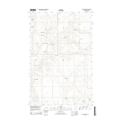
2014 Map of Miller Springs
USGS Topo · Published 2014About this map
Miller Springs and Johnson Springs highlight the critical water sources in this arid stretch of Valley County. The terrain is defined by a dense network of coulees and hills, where the landscape falls away into Rock Creek Canyon and rises into the Landre Hills. Water management is central to the land's utility, evidenced by a series of catchment basins such as Emory Reservoir, Mary Black Reservoir, and Bird Reservoir.
Find a feature on this map
36 named features on this map. Tap any name to fly to it.
Don’t see what you’re looking for? This feature index may not catch every label — zoom into the map to look around manually.
Map Details
Editions of this 2014 Miller Springs Map
This is the sole edition of this map. No revisions or reprints were ever made.
Other maps of this area

1906 · Hinsdale Special Map
USGS Topo · 1:62,500

1919 · Boundary
USGS Topo · 1:125,000

1943 · Glasgow
USGS Topo · 1:125,000

1954 · Glasgow
USGS Topo · 1:250,000

1957 · Glasgow
USGS Topo · 1:250,000

1958 · Glasgow
USGS Topo · 1:250,000
1969 · Tampico NE
USGS Topo · 1:24,000

1969 · Ellsworth Coulee
USGS Topo · 1:24,000

1984 · Laundry Hill
USGS Topo · 1:24,000

1984 · Opheim
USGS Topo · 1:100,000