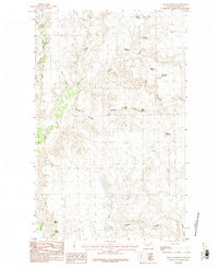
1984 Map of Miller Springs
USGS Topo · Published 1984About this map
Miller Springs and Johnson Springs anchor the southern reaches of this Valley County landscape, representing essential water sources in an area defined by its drainages and coulees. The map, compiled from 1974 aerial photography and edited in the early 1980s, reveals a network of small-scale water management features critical to the region's agricultural and ranching history. Numerous reservoirs, including Mary Black Reservoir, Emory Reservoir, and Book Reservoir, are scattered across the terrain to capture seasonal runoff from several creeks.
Find a feature on this map
23 named features on this map. Tap any name to fly to it.
Don’t see what you’re looking for? This feature index may not catch every label — zoom into the map to look around manually.
Map Details
Editions of this 1984 Miller Springs Map
This is the sole edition of this map. No revisions or reprints were ever made.
Other maps of this area

1906 · Hinsdale Special Map
USGS Topo · 1:62,500

1919 · Boundary
USGS Topo · 1:125,000

1943 · Glasgow
USGS Topo · 1:125,000

1954 · Glasgow
USGS Topo · 1:250,000

1957 · Glasgow
USGS Topo · 1:250,000

1958 · Glasgow
USGS Topo · 1:250,000
1969 · Tampico NE
USGS Topo · 1:24,000

1969 · Ellsworth Coulee
USGS Topo · 1:24,000

1984 · Laundry Hill
USGS Topo · 1:24,000

1984 · Opheim
USGS Topo · 1:100,000