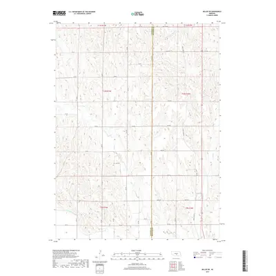
2017 Map of Miller SW
USGS Topo · Published 2017About this map
Dawson Co Buffalo Co line bisects this agricultural landscape in Nebraska, where a grid of rural roads defines the movement of water and commerce. The southwestern portion is dominated by the Dawson County Canal, a critical piece of water infrastructure for the region. The terrain is deeply carved by several drainages, most notably the meandering course of Turkey Creek and its namesake Turkey Creek Rd in the east, alongside Cherry Valley Cr and Bell Cr further west. This 2017 survey reveals the persistent section-line road network common to the Great Plains, featuring routes like Midway Rd and the aptly named Pole Line Rd. The map illustrates how local topography and water management systems like Elm Cr continue to shape the rural development and land use patterns at the border of Dawson and Buffalo counties.
Find a feature on this map
33 named features on this map. Tap any name to fly to it.
Don’t see what you’re looking for? This feature index may not catch every label — zoom into the map to look around manually.
Map Details
Editions of this 2017 Miller SW Map
This is the sole edition of this map. No revisions or reprints were ever made.
Other maps of this area

1896 · Lexington
USGS Topo · 1:125,000

1896 · Kearney
USGS Topo · 1:125,000

1899 · Lexington
USGS Topo · 1:125,000

1955 · Grand Island
USGS Topo · 1:250,000

1957 · Grand Island
USGS Topo · 1:250,000

1958 · Grand Island
USGS Topo · 1:250,000

1961 · Elm Creek West
USGS Topo · 1:24,000

1961 · Amherst
USGS Topo · 1:24,000

1961 · Miller SW
USGS Topo · 1:24,000

1962 · Elm Creek East
USGS Topo · 1:24,000