
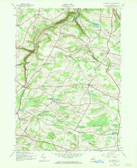
1943 Map of Millers Mills
USGS Topo · Published 1960About this map
Millers Mills and the surrounding dairy country of Herkimer County appear here at a time when rural life was still defined by small schoolhouse districts and precise corner settlements. The landscape is deeply carved by glacial geology, most notably the steep Gorge and the winding Polly Miller Gulf, which dictated the early road network through Litchfield and Columbia. This 1943 survey shows the Delaware Lackawanna and Western railroad cutting across the southern portion of the sheet, connecting agricultural hubs like Cedarville Station to larger regional markets.
Find a feature on this map
57 named features on this map. Tap any name to fly to it.
Don’t see what you’re looking for? This feature index may not catch every label — zoom into the map to look around manually.
Map Details
Editions of this 1943 Millers Mills Map
2 editions found
Other maps of this area

1898 · Utica
USGS Topo · 1:62,500

1900 · Little Falls
USGS Topo · 1:62,500

1900 · Utica
USGS Topo · 1:62,500

1903 · Richfield Springs
USGS Topo · 1:62,500

1903 · Little Falls
USGS Topo · 1:62,500

1907 · Winfield
USGS Topo · 1:62,500

1939 · Little Falls
USGS Topo · 1:62,500

1943 · Schuyler Lake
USGS Topo · 1:24,000

1943 · Utica East
USGS Topo · 1:24,000

1943 · Jordanville
USGS Topo · 1:24,000