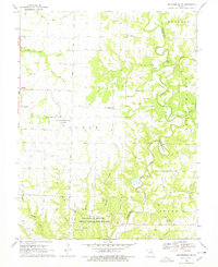
1969 Map of Millersburg SW
USGS Topo · Published 1978About this map
Columbia Regional Airport occupies a central position on this landscape, its expansive grounds contrasting with the intricate network of creek drainages that define the surrounding terrain. To the south, the University of Missouri Ashland Wildlife Research Area preserves a significant portion of the drainage basins for Brushy Creek and Conner Creek, featuring the Laboratory Dam. The eastern portion of the map is dominated by the steep bluffs of the Cedar Creek valley, where topographic landmarks like Devils Backbone and Mill Site Bluff rise above the winding watercourse. Settled life is reflected in small communities like Englewood and Deer Park, along with rural landmarks such as Barnes Chapel and Oak Chapel. Genealogists may find value in several family burial grounds, including Harris Cem, Johnson Cem, and Barger Cem, which are scattered throughout the hills north of the Round Prairie region.
Find a feature on this map
43 named features on this map. Tap any name to fly to it.
Don’t see what you’re looking for? This feature index may not catch every label — zoom into the map to look around manually.
Map Details
Editions of this 1969 Millersburg SW Map
4 editions found
Other maps of this area

1886 · Jefferson City
USGS Topo · 1:125,000

1894 · Jefferson City
USGS Topo · 1:125,000

1935 · Columbia
USGS Topo · 1:24,000

1939 · Jefferson City
USGS Topo · 1:62,500

1940 · Columbia
USGS Topo · 1:24,000

1942 · Jefferson City
USGS Topo · 1:62,500

1944 · Millersburg
USGS Topo · 1:62,500

1946 · Millersburg
USGS Topo · 1:62,500

1947 · Jefferson City
USGS Topo · 1:250,000

1948 · Centertown
USGS Topo · 1:62,500