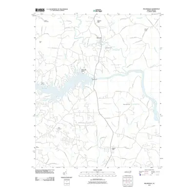
2010 Map of Millersville
USGS Topo · Published 2010About this map
The Catawba River serves as the central focal point of this 2010 landscape, controlled by massive infrastructure like the Oxford Dam and the North State Dam. These structures define the local hydrology, creating the wide reaches of the river and nearby Rink Lake that shape the area's recreation and settlement patterns. The community of Millersville sits just north of the river, while Taylorsville Beach hugs the shoreline, illustrating the region's transition into a residential and water-focused corridor.
Find a feature on this map
78 named features on this map. Tap any name to fly to it.
Don’t see what you’re looking for? This feature index may not catch every label — zoom into the map to look around manually.
Map Details
Editions of this 2010 Millersville Map
This is the sole edition of this map. No revisions or reprints were ever made.
Other maps of this area

1895 · Hickory
USGS Topo · 1:125,000

1953 · Charlotte
USGS Topo · 1:250,000

1954 · Charlotte
USGS Topo · 1:250,000

1960 · Charlotte
USGS Topo · 1:250,000

1962 · Charlotte
USGS Topo · 1:250,000
1970 · Hiddenite
USGS Topo · 1:24,000

1970 · Bethlehem
USGS Topo · 1:24,000

1970 · Newton
USGS Topo · 1:24,000
1970 · Catawba
USGS Topo · 1:24,000
1970 · Ellendale
USGS Topo · 1:24,000