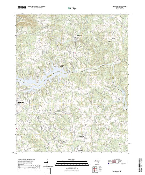
2022 Map of Millersville
USGS Topo · Published 2022About this map
Lake Hickory and the Catawba River define the central geography of this region along the boundary of Alexander and Catawba counties. The landscape transitions from the elevations of Barrett Mtn and Buck Hill in the northwest down to the water-oriented communities like Taylorsville Beach. This modern topographic perspective reveals a well-developed network of rural and suburban residential corridors, including numerous family-named roads such as Earl Icenhour Ln and Hines Farm Rd, which point to the area's agricultural lineage and land divisions.
Find a feature on this map
184 named features on this map. Tap any name to fly to it.
Don’t see what you’re looking for? This feature index may not catch every label — zoom into the map to look around manually.
Map Details
Editions of this 2022 Millersville Map
This is the sole edition of this map. No revisions or reprints were ever made.
Other maps of this area

1895 · Hickory
USGS Topo · 1:125,000

1953 · Charlotte
USGS Topo · 1:250,000

1954 · Charlotte
USGS Topo · 1:250,000

1960 · Charlotte
USGS Topo · 1:250,000

1962 · Charlotte
USGS Topo · 1:250,000
1970 · Hiddenite
USGS Topo · 1:24,000

1970 · Bethlehem
USGS Topo · 1:24,000

1970 · Newton
USGS Topo · 1:24,000
1970 · Catawba
USGS Topo · 1:24,000
1970 · Ellendale
USGS Topo · 1:24,000