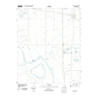
2010 Map of Millerton
USGS Topo · Published 2010About this map
The Red River defines the southern boundary of this McCurtain County landscape, where the Oklahoma-Texas border is marked by a State Boundary Reference Monument near the wide riverbanks. This 2010 survey shows a complex hydrological system of sloughs and reservoirs, including the Horseshoe Bend Cutoff and the Whitegrass-Waterhole Creeks Site 1 Reservoir. The terrain transitions from the low-lying Whitegrass Flats to the small settlements of Millerton and Mount Zion further north.
Find a feature on this map
27 named features on this map. Tap any name to fly to it.
Don’t see what you’re looking for? This feature index may not catch every label — zoom into the map to look around manually.
Map Details
Editions of this 2010 Millerton Map
This is the sole edition of this map. No revisions or reprints were ever made.
Other maps of this area

1901 · Alikchi
USGS Topo · 1:125,000

1902 · Lukfata
USGS Topo · 1:125,000

1950 · Mcalester
USGS Topo · 1:250,000

1950 · Acworth
USGS Topo · 1:24,000

1951 · Garvin
USGS Topo · 1:24,000

1951 · Acworth
USGS Topo · 1:24,000

1951 · Millerton
USGS Topo · 1:24,000

1951 · Negley
USGS Topo · 1:24,000

1951 · Kiomatia
USGS Topo · 1:24,000

1951 · Manchester
USGS Topo · 1:24,000